General
views of the Withington area, taken mainly in May 2010,
together with historical notes, and a section on Withington
Hospital and Workhouse.
 Wilmslow
Road, looking north to the village
centre.
This is now a very busy north-south
route
into under the Manchester and Wilmslow
Turnpike
which was created by an Act of
Parliament
in 1753. The Trust was abolished
in
1881. The road had toll-bars at various
times
at Mauldeth Road, Burton Road, Cotton
Lane
and Fog Lane.* See the Village
history
|
 An
old milestone on Wilmslow Road. At one
time
(see the 1934
OS map in Withington,
both
Wilmslow Road and Palatine Road had
milestones
or mileposts at 1/3-mile intervals.
This
is the only one which survives.
|
 The
White Lion underwent renovation in 2010
2010
and the ground floor is now a
mini-supermarket.
This is at least the
second
"White Lion" to occupy the site
on
the corner of Wilmslow Road and
Burton
Road. The basement of the
building
contains a well, and the
building
itself has some splendid
original
stained glass. At one time, it
was
the custom for the White Lion to
present
May Day prizes to villagers. The
present
building has a date plaque on
the
north wall of 1880.
|
 The
water trough, now in Copson Street,
was
originally on Wellington Road at its
junction
with Wilmslow Road near the
library.
It was later moved to the corner
between
Palatine and Wilmslow Roads
opposite
the White Lion, and then,
possibly,
to a site by Withington Green.
See
the Village
history for details of the
trough,
its loss and its subsequent
recovery.
|
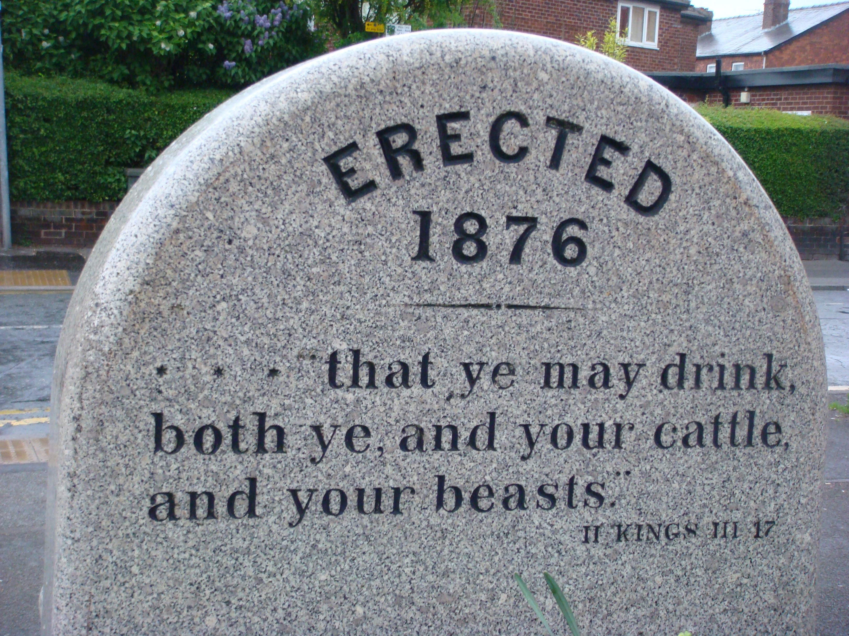 Inscription
on the water trough: Appropriately
chosen
- the trough provides water for people
(a
drinking fountain), for horses and, at the
side,
for dogs (see previous picture).
|
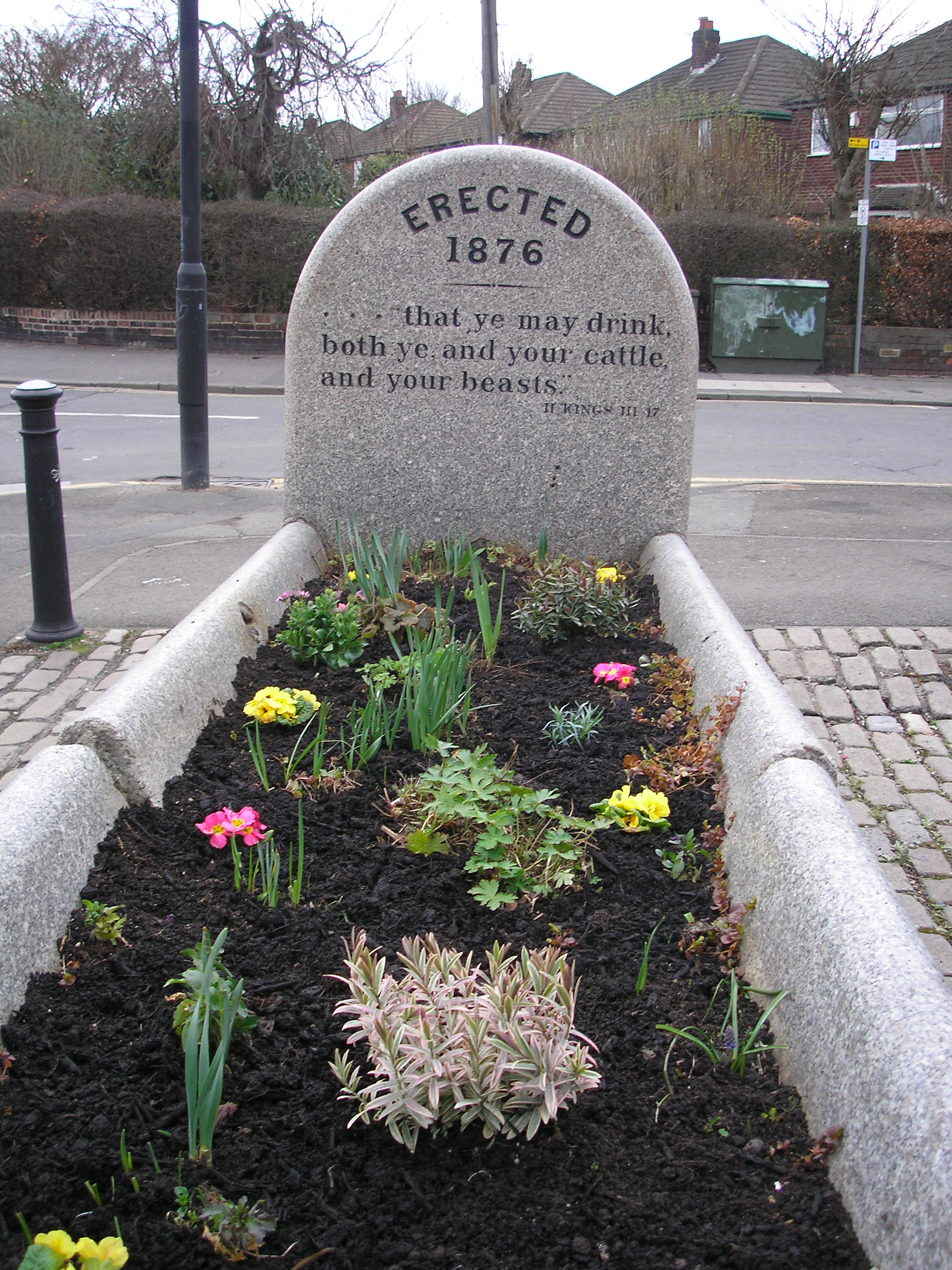 Spring
planting in the water trough
|
 The
"Old House at Home" public house on
Burton
Road. Developed from a row of
five
cottages (2010).
This old pub has now
been
demolished and replaced by a
housing
development.
|
 St.
Cuthbert", the church was established
in
1874, and the nave opened in 1881.
The
building was extended in 1902.
The
building alongside (1891)
was
a catholic school until a new
school
was built on Cotton Lane.
|
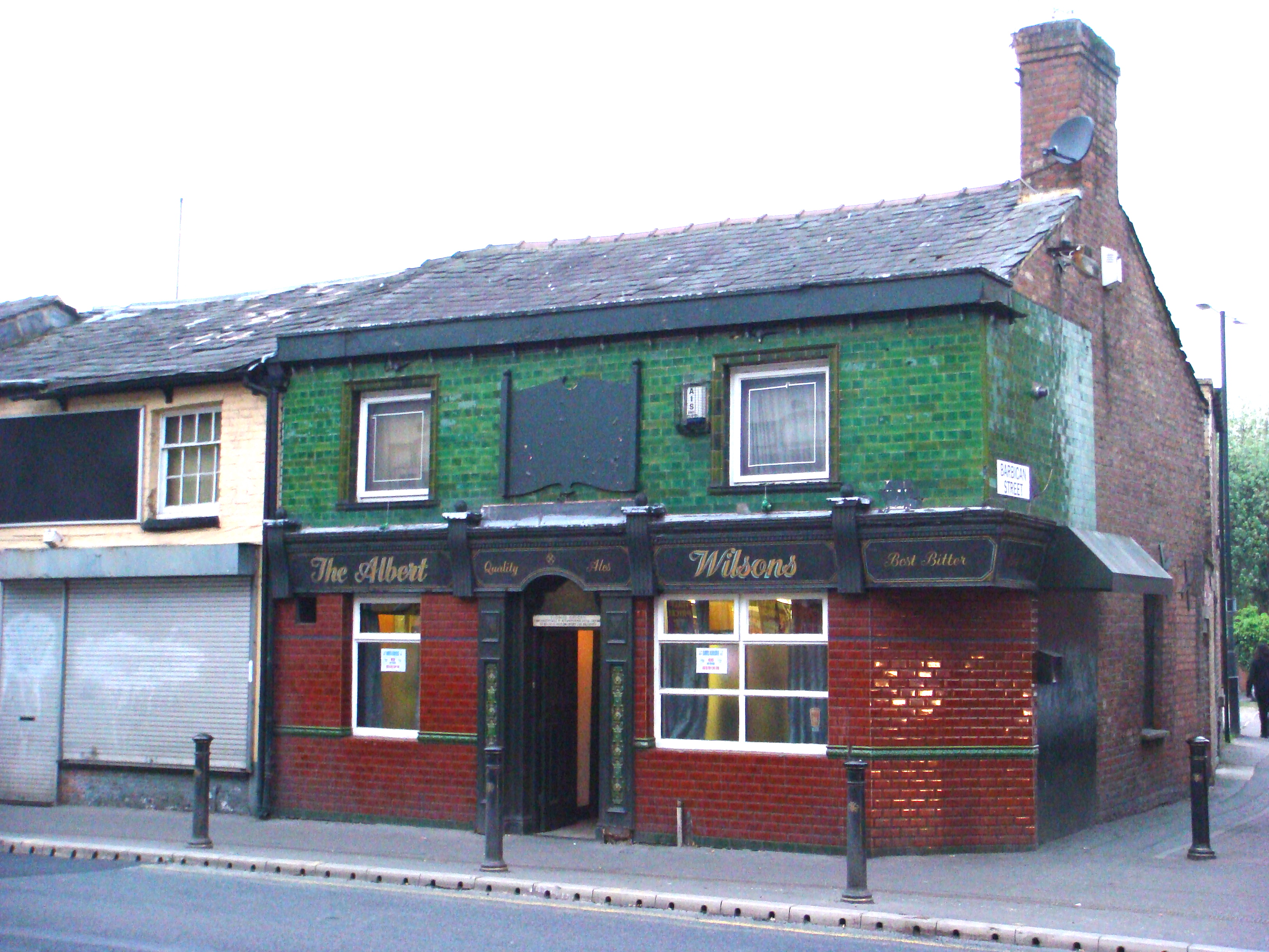
 The
Albert public house in Withington village
centre. See
the Village
history for more details.
|
 The former
Withington Town Hall (1881)
on Lapwing Lane. Withington Local Board
provided
local government for the area
from
1876 to 1894.
|
 Pediment
of the former Withington Town Hall -
notice
the "WLB" inscription.
|
 Withington
Methodist Church, in the village
centre. This building was opened in 1865.
Previously,
the Methodist chapel was on
Old
Hall Lane, in Old Moat. See the
Village
history for more information.
|
 St.
Chad's Church, Ladybarn. The original
building
was dedicated in 1900. This building
was
designed by W. Cecil Hardisty and
consecrated
in 1907, superseding the
original
iron structure. The organ is by
Harrison
and Harrison Ltd and is
Grade
II listed on a national scale.
|
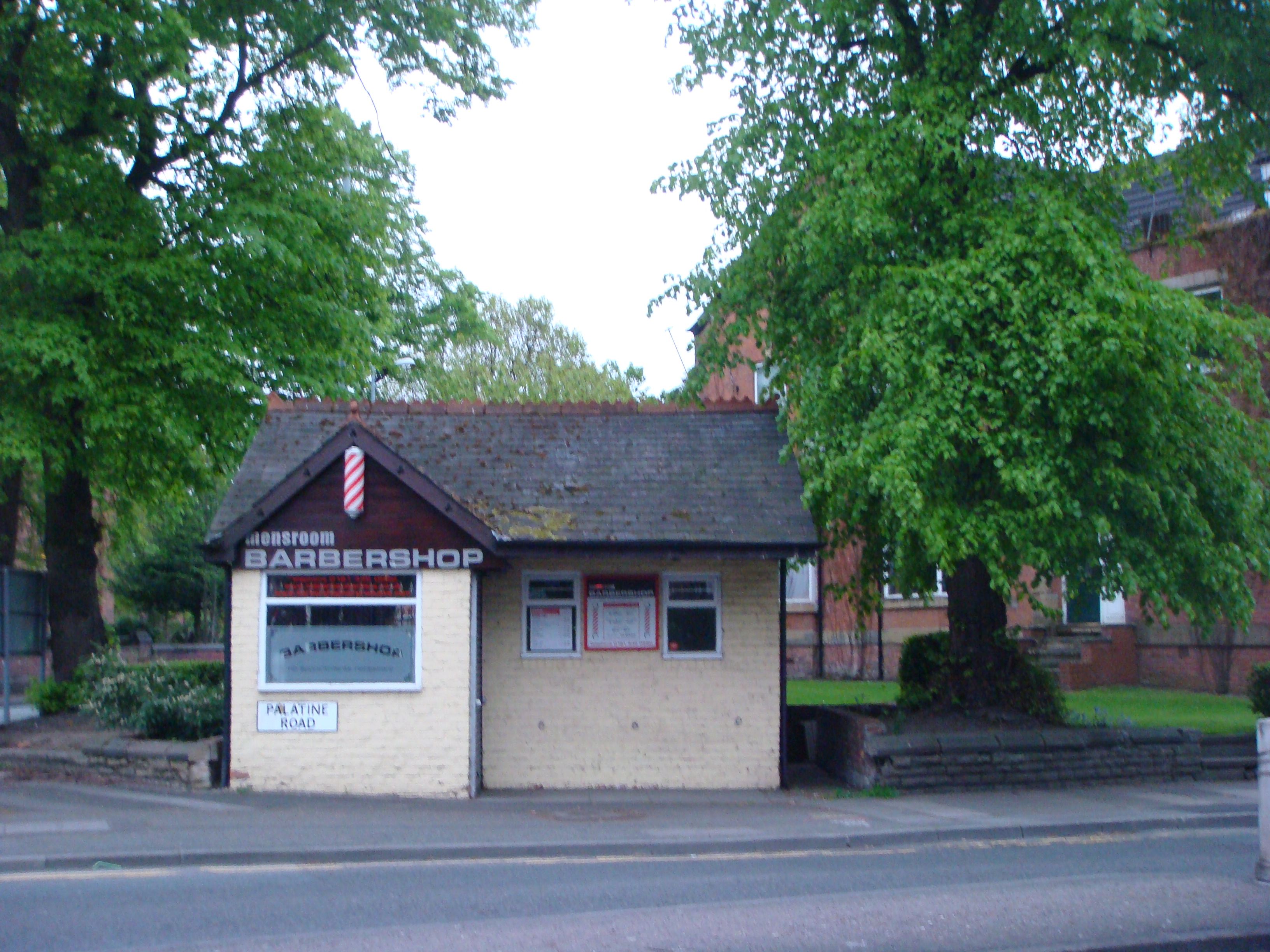 A
small building at the main junction in
Withington.
Now serving as a barber's
shop,
it was a shelter for transport (bus?) inspectors.
|
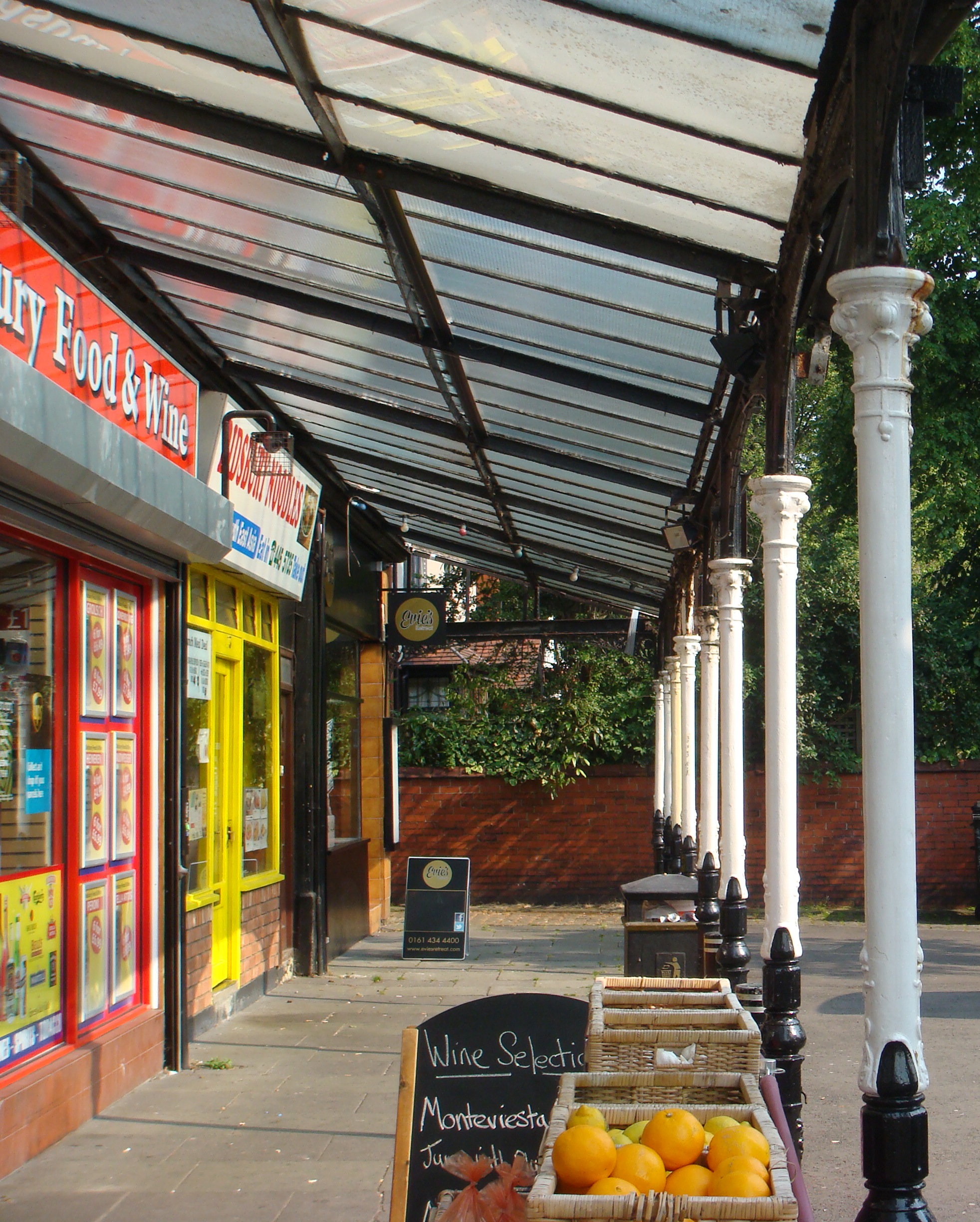 The
Lapwing Lane arcade. This lovely
piece
of ironwork was erected in 1913.
Here
is
old photograph of the arcade
in
the 1920s. The
Friends website has
a
detailed history (with the occupying
shops)
and some old photographs.
[July
2013]
|
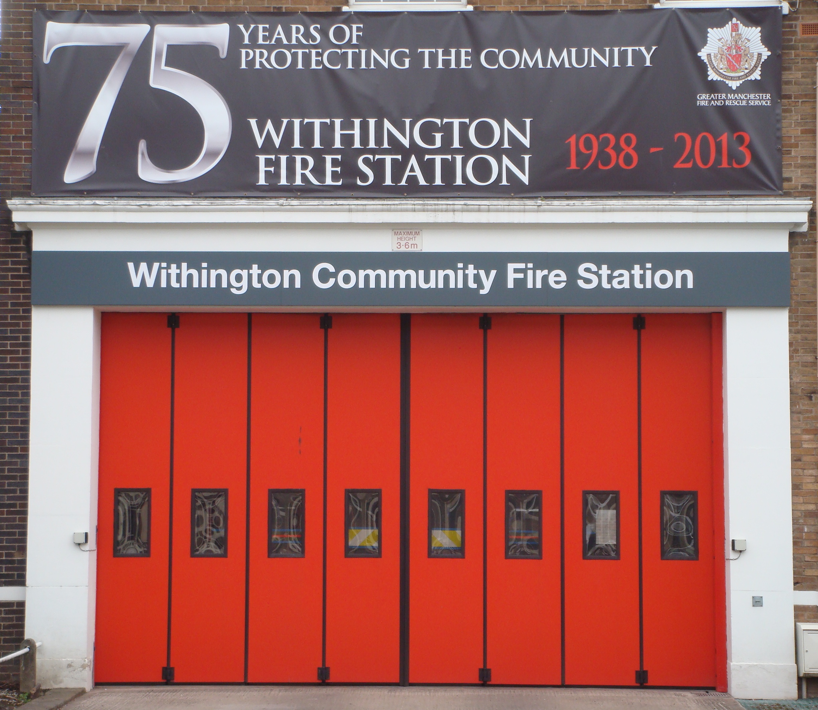 Banner
celebrating the 75th anniversary
of
the Withington Community Fire Station.
A party
was held to celebrate this event.
For
the history of the Fire Station
see
the Village
history. [July 2013]
|
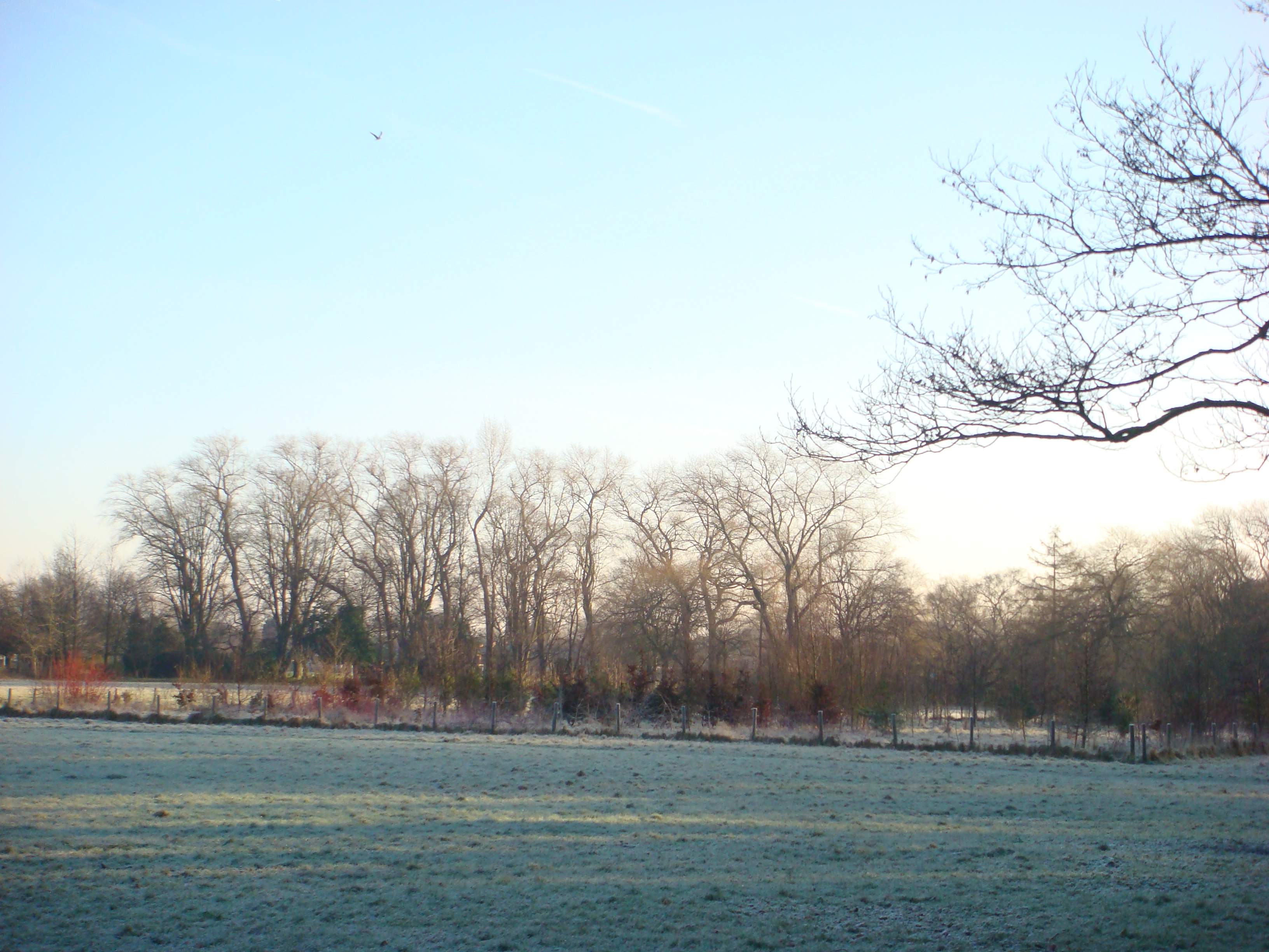 A
winter view of Fog Lane Park.
[Photo:
Jan 2012]
|
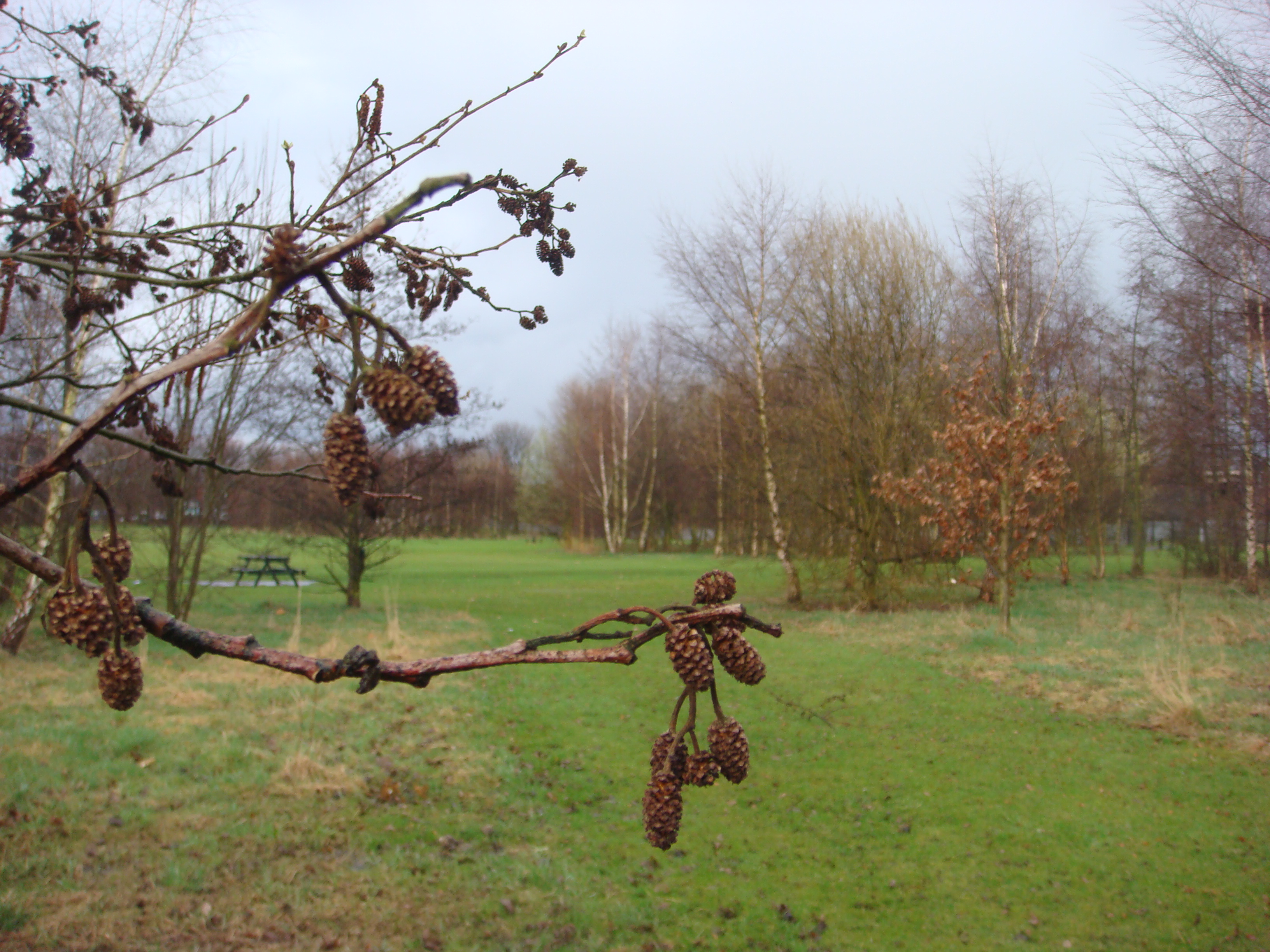 Woodland
in Ladybarn Park.
|
*
The route of Wilmslow Road is an ancient one. According to
Kenneth Whittaker (A History of Withington), it is
recorded as far back as the 1200s. There is a map of
so-called "saltways" between Cheshire and Manchester
(courtesy of The Lancashire and Cheshire Antiquarian
Society) which shows this route as a medieval
"saltway".
Withington
Hospital and Chorlton Union Workhouse
Withington
Hospital developed from the Chorlton
Union Workhouse on a site between Burton Road and
Princess Road. As the hospital developed, the
magnificent Victorian buildings became surrounded by
additional hospital buildings on a large site and the
hospital became one of the largest teaching hospitals in
Europe.
For
a detailed history, see the Wikipedia
page. In the 1990s and early 2000s, the hospital
closed and housing was developed on the site. However, the
most impressive of the old buildings have been restored as
accommodation with new gardens in parterre design. Many of
the other hospital buildings have been demolished and
replaced with housing. Here are a few pictures of the
development (May 2010) with building work still in
progress.
 The
grand entrance to the main Victorian building.
Notice the new parterre gardens.
|
 A
view of the main Victorian building.
|
 Another
view of the main building.
|
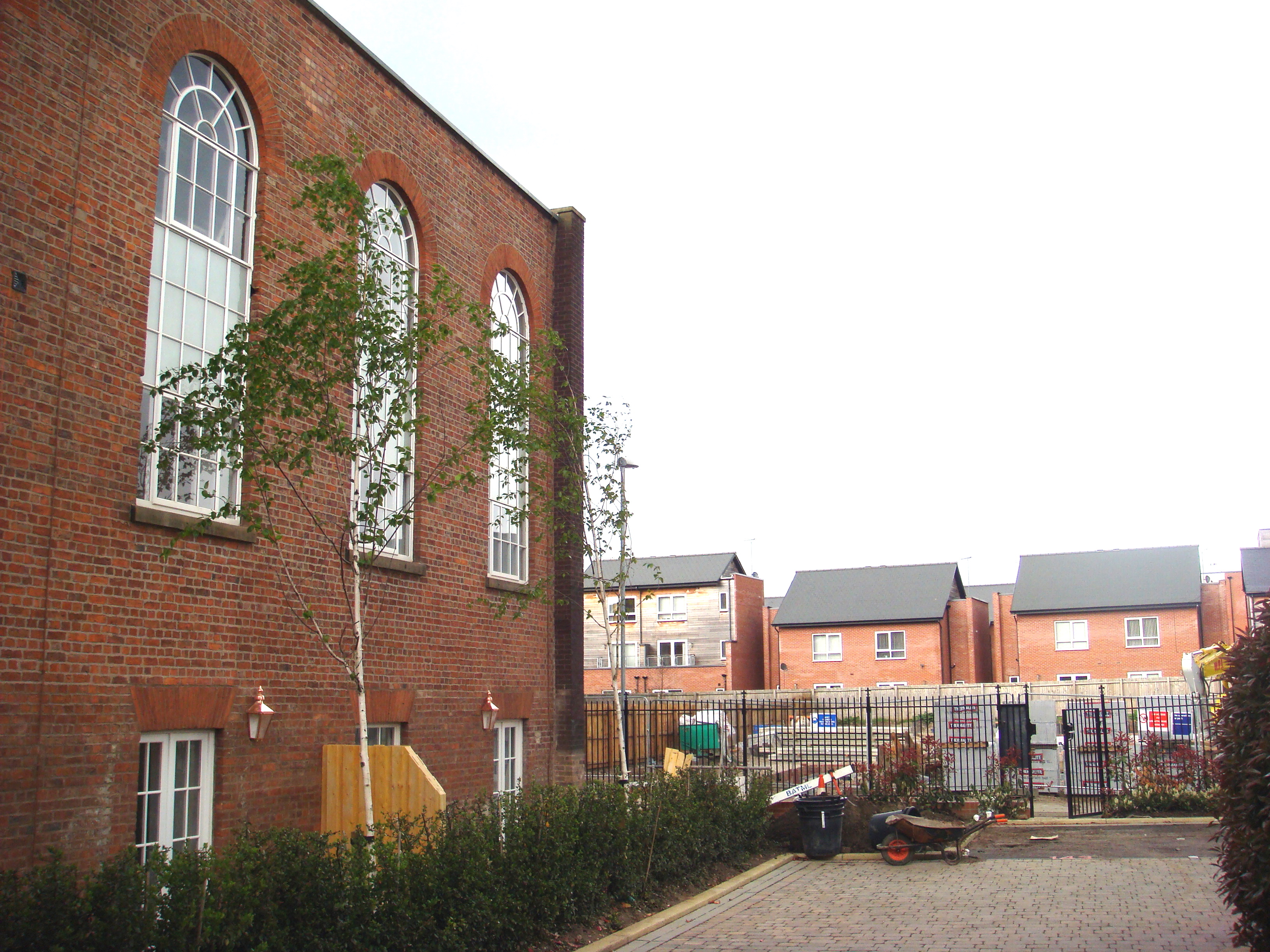 Old
and new - new houses built on the old hospital site.
|
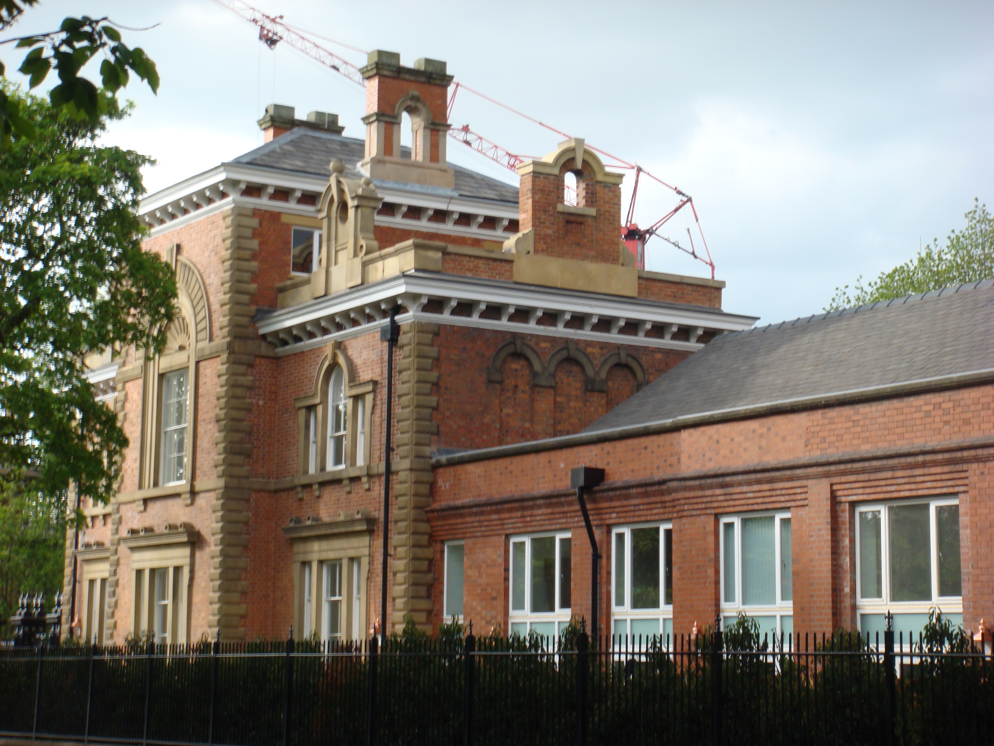 Part
of the Victorian frontage.
|
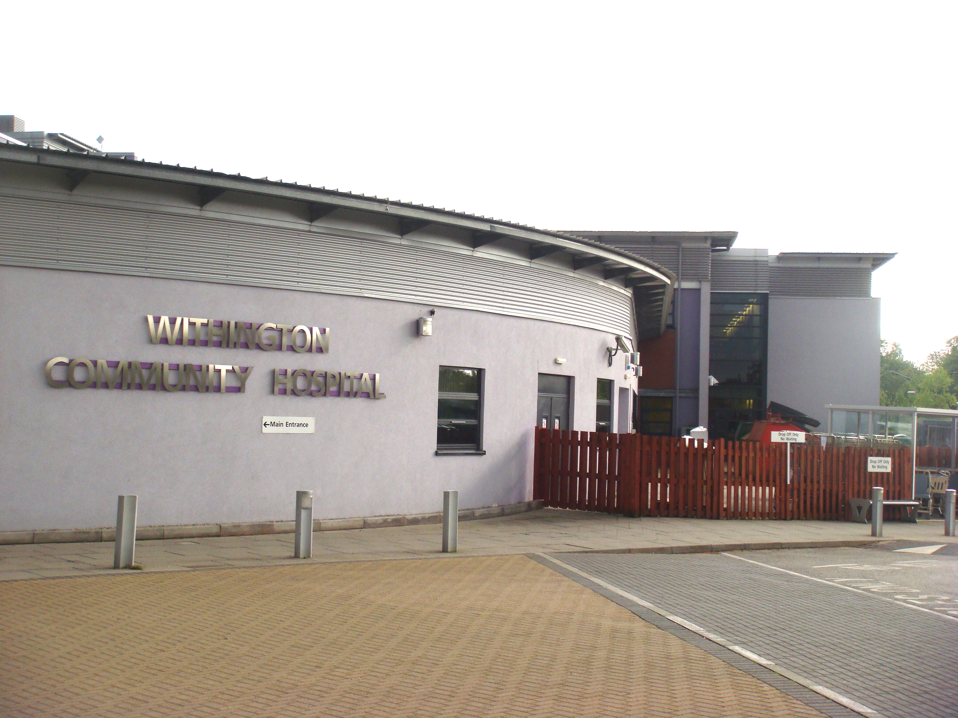 The
new Community Hospital built opposite the old
Withington Hospital.
|