This
is a guide to old maps of Withington, Old Moat and
Ladybarn. Included is a collection of maps for you to
view or download
.Click
on each image for a larger view.
To
browse in detail, click on the enlarged view to get a highly
magnified view.
-
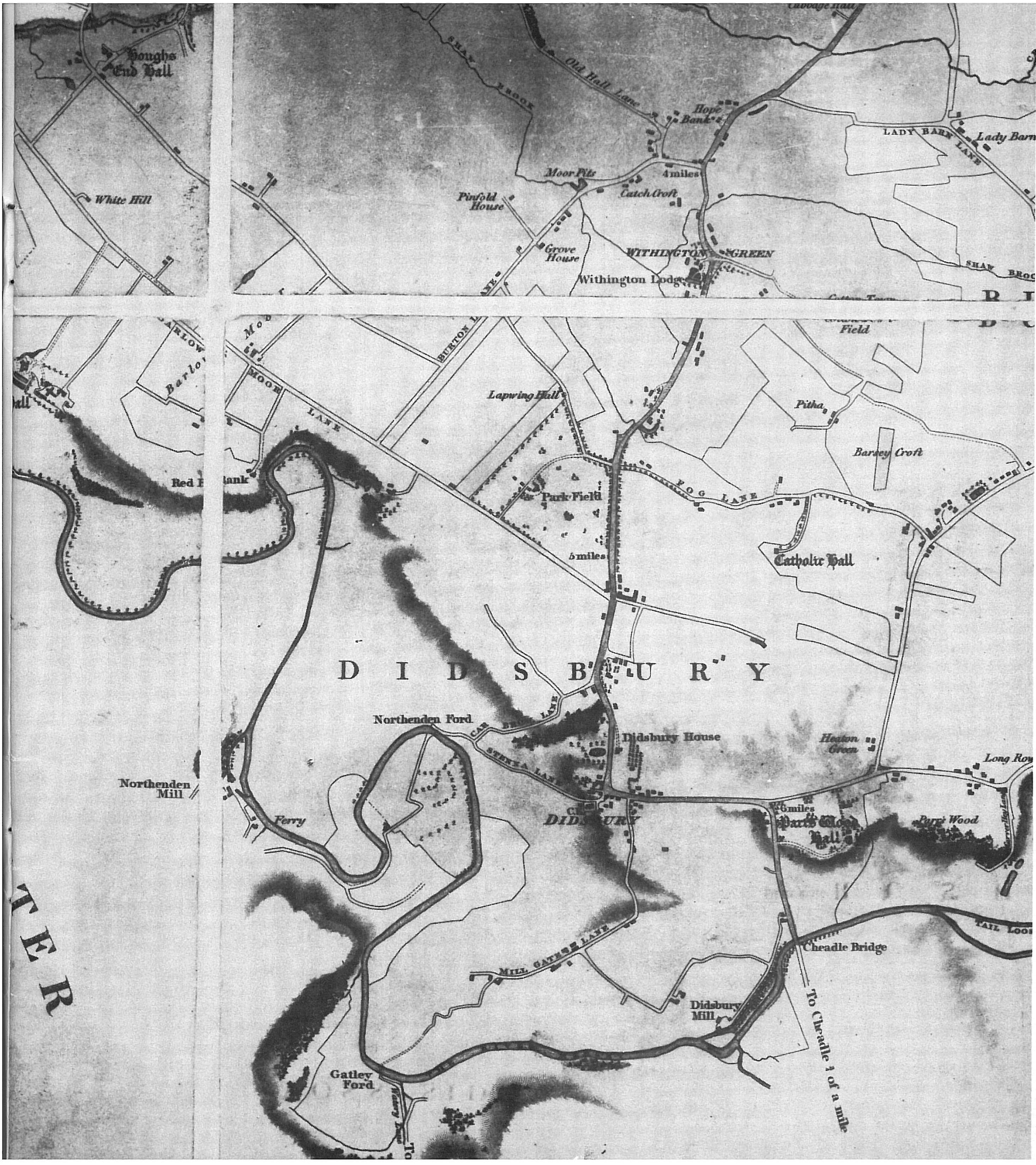
William Johnson's Plan of the Parish of Manchester, in the County of Lancaster (1820): Withington and Didsbury.From a survey made in the years 1818 and 1819 by William Johnson, Manchester. Published by William Johnson, Surveyor, Faulkner Street, July 1st, 1820.
The area was entirely rural at the time. Some of the road system is established and Withington is recorded as "Withington Green".

From
the Egerton family archives
Yates' Survey of Lancashire
The
following three maps (supplied by Cliff Pelham) are
provided courtesy of Manchester Libraries,
Information and Archives (Greater Manchester County
Record Office, Manchester Archives) and come from
the Egerton family archive. If you download these,
please acknowledge their source.
-
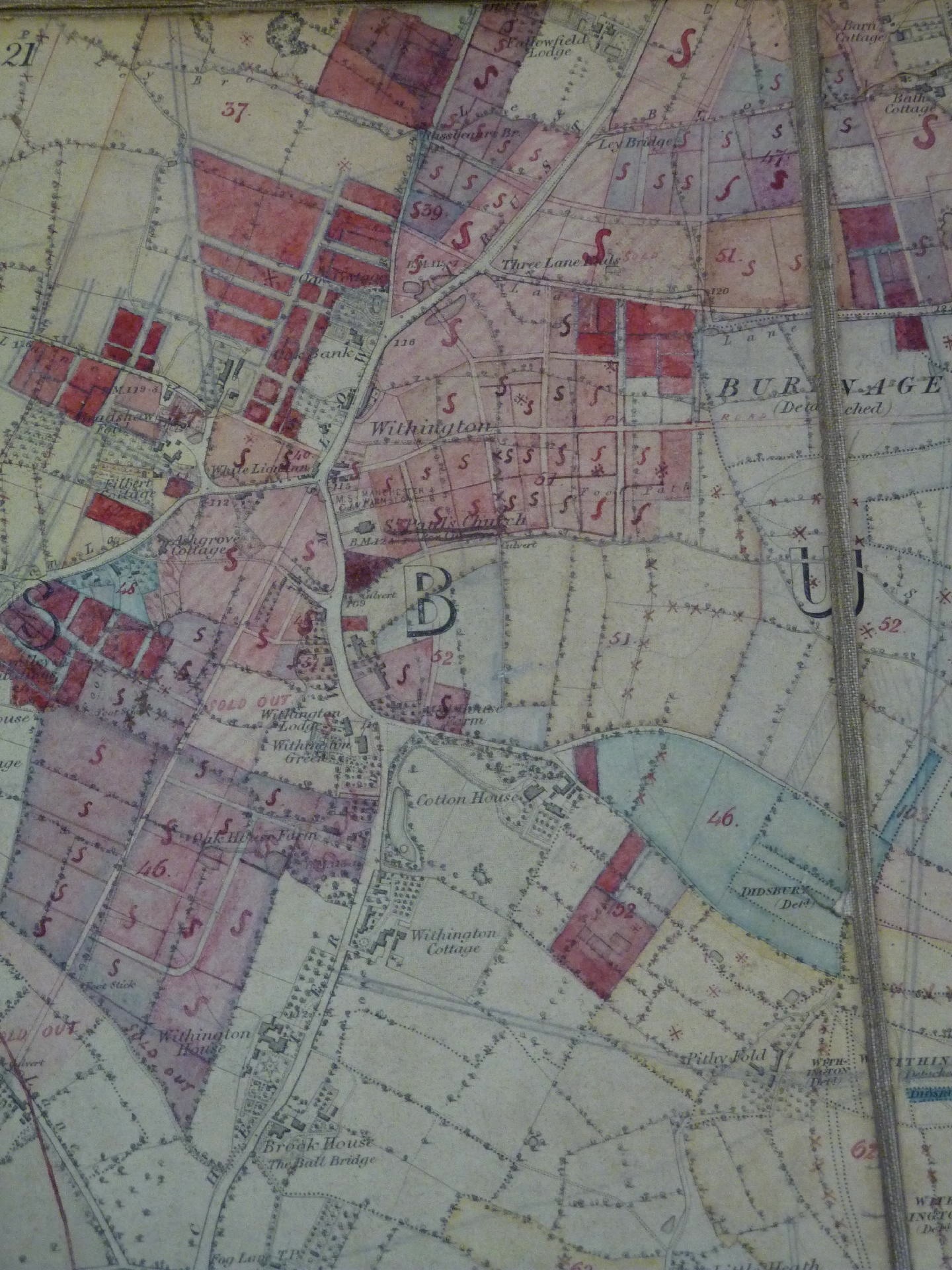
Withington O.S. map, 1862, annotated with plots for sale. The Egertons were the major landowners in the area at the time. Notice Cotton House and Withingon Cottage both with gardens, St. Paul's Church and also Withington Green.
-
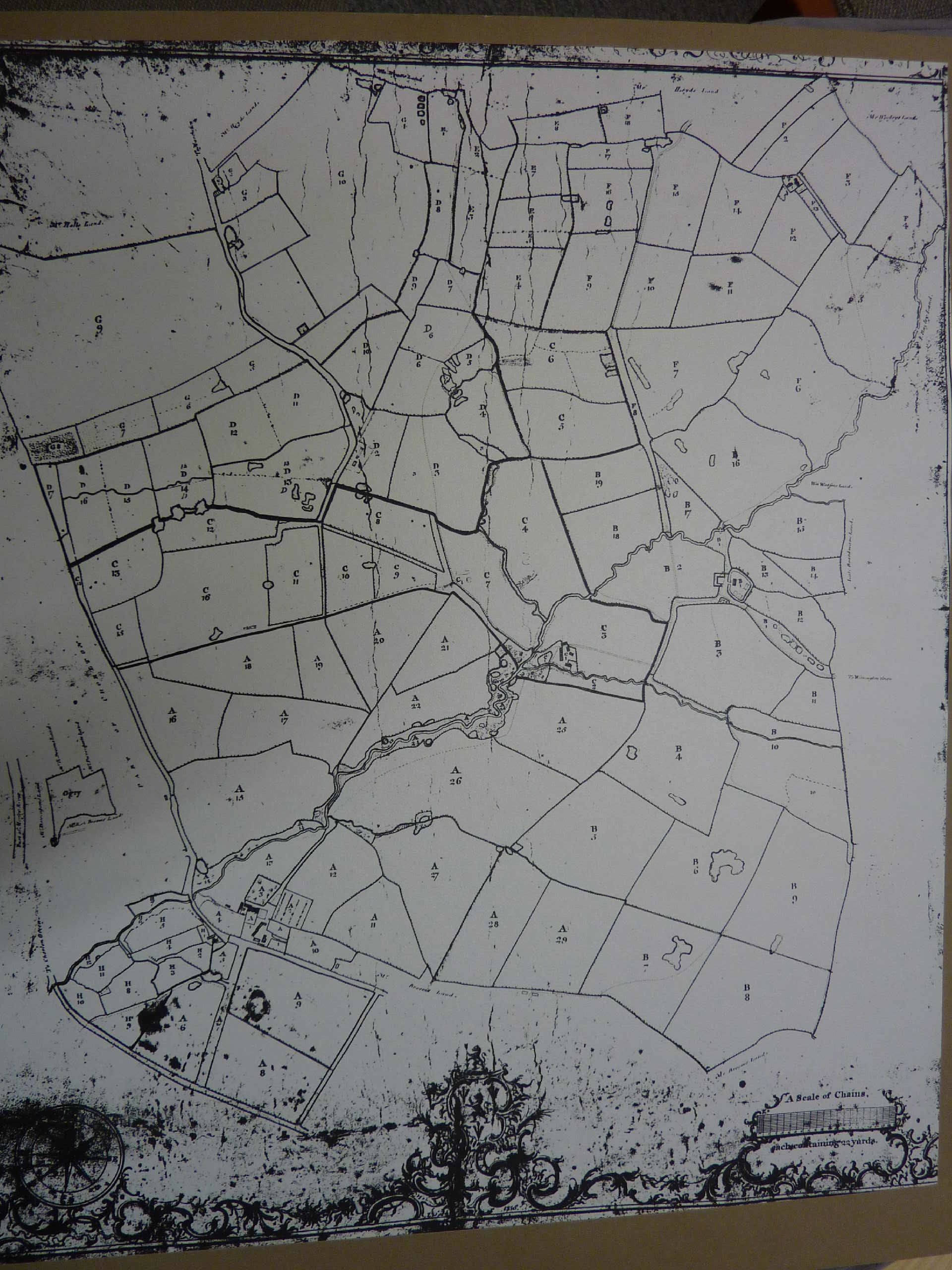
Part of the Withington Demesne, 1758. Withington Old Hall and the moat can be seen middle right and the area extends towards Chorlton, covering part of what is now Old Moat and Hough End. The brooks from the east converge and flow through Hough End Clough in the centre of the map. To orient with the modern road system, Princess Road now runs between Withington Old Hall and Hough End Clough just to the left of the Hall.
-
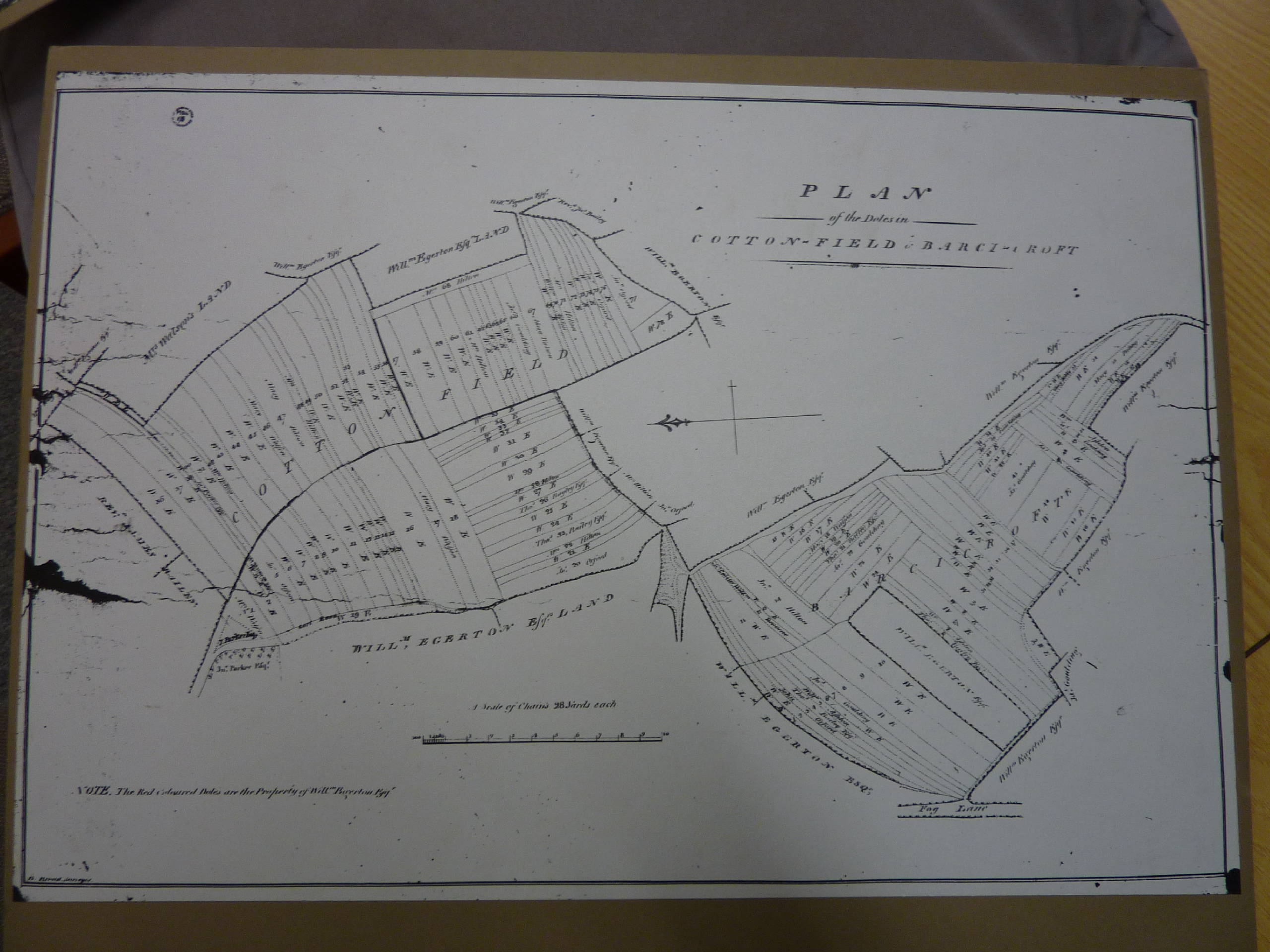
The Cotton-field and Barcicroft Doles - part of the old field system in the Cotton Lane area, 1799.


Yates' Survey of Lancashire
The
County Palatine of Lancaster, surveyed
by William Yates (1786). This has been
reprinted by Neil Richardson (Swinton) in
1982 and is available on CD.
It
is an early map of the area and despite the
size of the region covered, it is very
detailed with individual buildings marked.
The map is available here from
the Lancashire County Council (again click
on the image for a magnified view).
Other
maps of Lancashire, covering the Withington area, from
the Lancashire
County Council archive are:
-
1818 (click to magnify).
-
1828-1830. Withington is in sector G6 - click on the map twice to get a fully magnified image.
-
John Speed's (1610) decorative map of Lancashire - again clickable. Marking "Diddesbury" and "Hughhall" but not Withington.
-
The "Gough Map" of 1360 (which is clickable). The orientation is with North to the left. This version of the map gives up at Manchester - an "MA..." is visible above "Fluvium Mersee". The County archive says: "The so-called Gough Map is the earliest surviving map of Britain dating from c.1360. Its origins are unknown and owes it name to Richard Gough (1735-1809), in whose collection it was found. This extract is from the OS 1935 facsimile which is reasonably legible. The original is coloured and is in the Bodleian Library, Oxford but is much less legible. An online version of the original has now been made available by Queen's University, Belfast". See The Digital Gough Map for an online version of a coloured Gough map of Britain.
Tithe
maps of the area (1839-1848) provide a
detailed record before major urbanisation
began.
Copies
of the tithe maps for villages/townships
in South Manchester and N.E. Cheshire
have been redrawn and annotated by Frank
and Teretta Mitchell (Gatley). These are
both attractive and informative. Some
are available in local libraries, all
are in the map collection of the
University of Manchester Library, which
also includes an interesting copy by the
same authors of A
true Mappe or Topologicall Description
of the Lordshippe of Northenden (1641).
The following tithe map copies (as well
as copies of tithe maps for Didsbury,
the Heatons, Cheadle, Northenden and
others) are available for purchase
(proceeds go to local charities) from
Diana Leitch
(diana.leitch@googlemail.com).
-
Tithe Map of Withington NW (1839-1848)
- Tithe Map of Withington NE (1839-1848)
-
Tithe Map of Withington SW (1839-1848)
-
Tithe Map of Withington SE (1845-1848)
Index
to Tithe Survey, Sheet 81 North West. Electrotype 1864. Reproduced
by courtesy of the University Librarian and Director,
The John Rylands Library, The University of Manchester:

Important
records of the Victorian and Edwardian development of
Withington are the Ordnance Survey maps of the late 19th
century and early 20th century. Large scale (1:2500) OS
maps of 1892 and 1916 have been republished in an
attractive form, with historical notes, by Alan
Godfrey Maps (the historical notes are
particularly interesting as they include names and
occupations of householders).
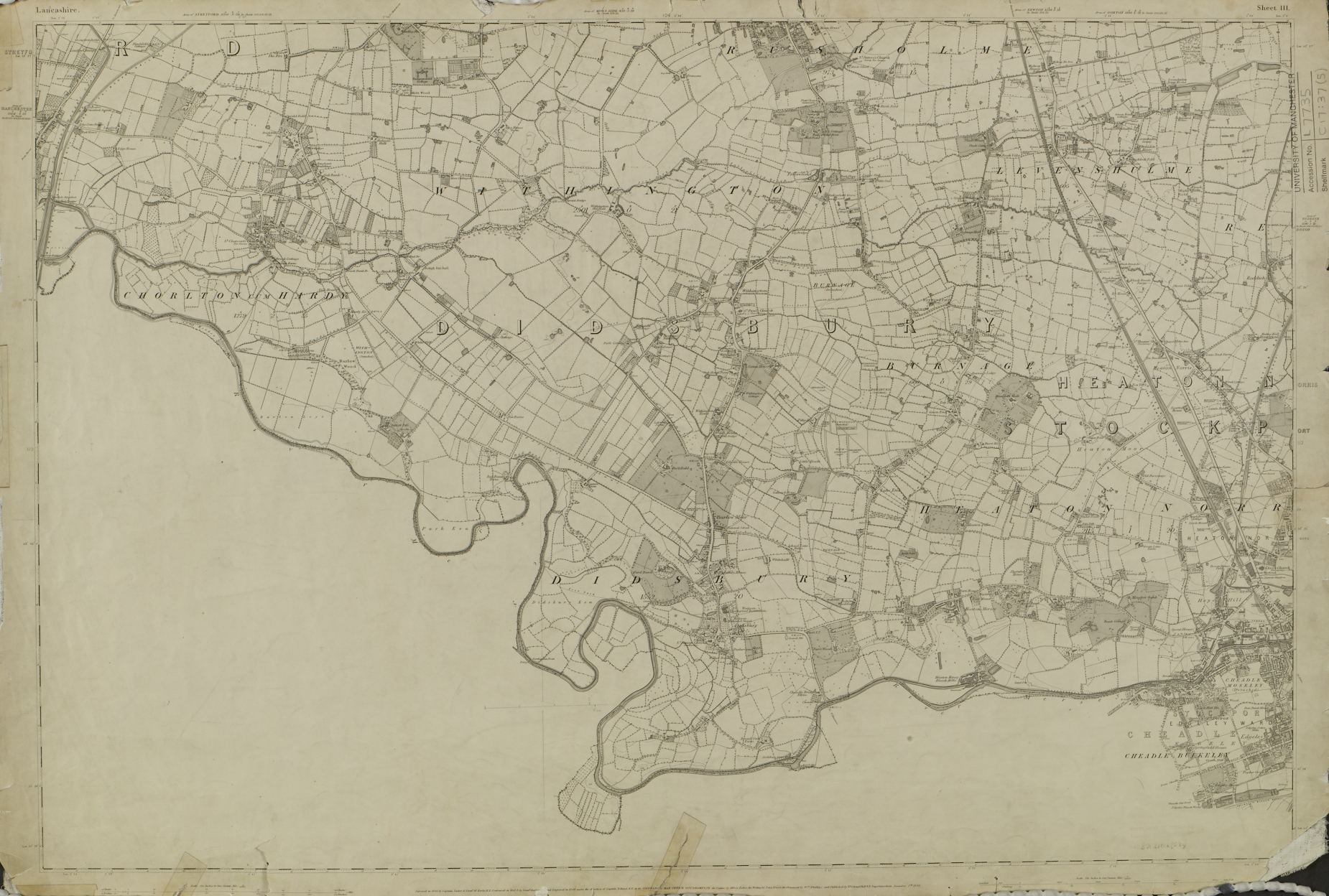
Ordnance
Survey County series 6” to 1 statute mile, Lancashire
Sheet III (1848). Surveyed by Captain Tucker and
Lieut. McKerlie R.E. Survey 1845, Engraved and Published
1848. Reproduced by courtesy of the University Librarian
and Director, The John Rylands Library, The University of
Manchester:
An
annotated copy of the 1862 Ordnance Survey is available above.
More recent maps
Recommended
as a visual record of the urbanisation of Withington, and
Manchester in general, is the Past
and Present Map (1842-present) Manchester
(Central) 1:50 000, which aligns 4 Ordnance Survey maps
from 4 periods - the Old Series, the Revised New Series,
the Popular Edition and the current 1:50 000. It is
available from Cassini
Maps.
More recent maps
Maps
of the 1930s are of considerable interest as they retain many
of the Victorian buildings, now lost, but also twentieth
century expansion, especially council-led housing schemes.
OS
County Series, 22" to 1 mile, Lancashire 111.7, 1934 Revision:
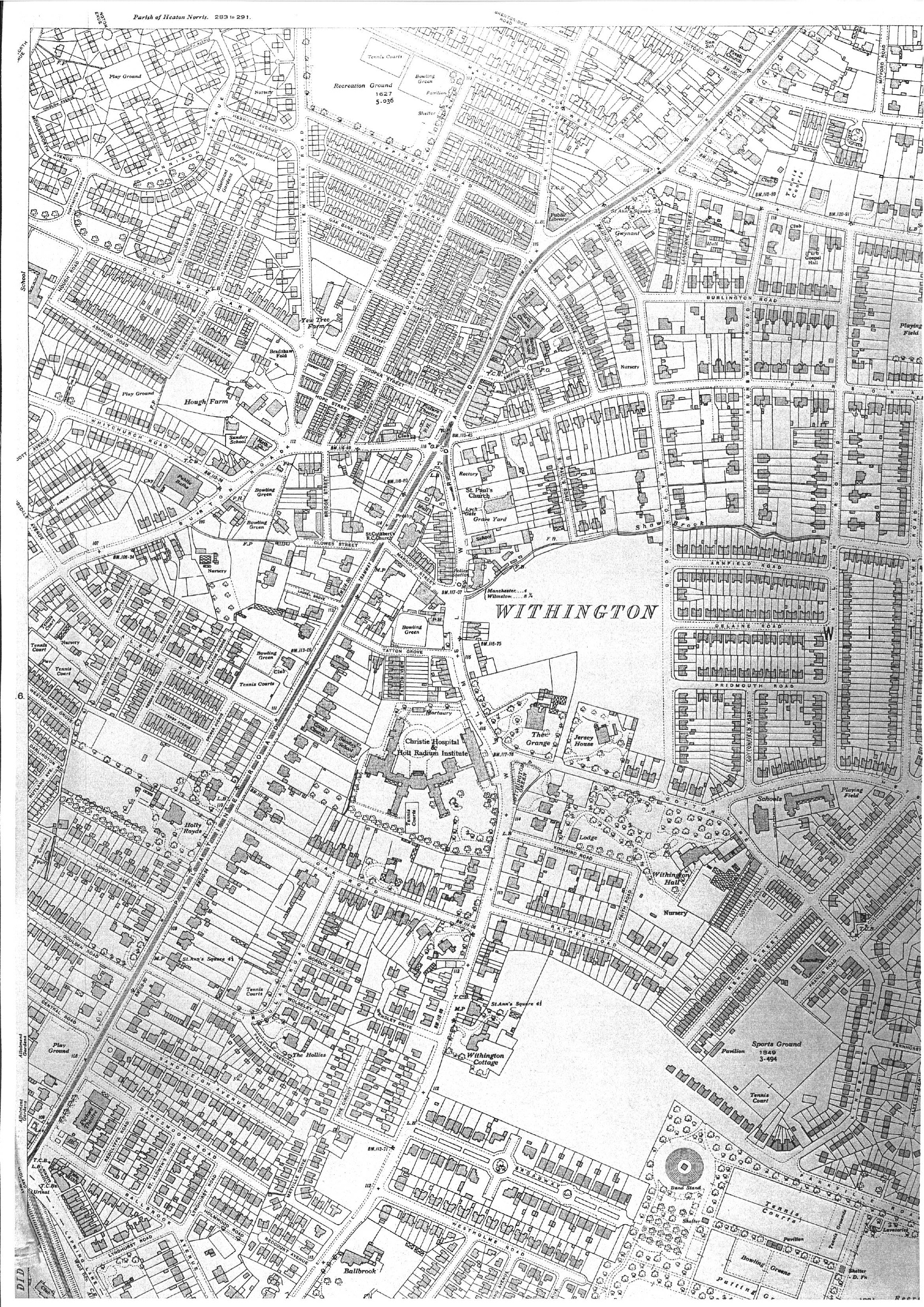
As
usual, click once on the map to enlarge, and then on a
position in the map to get full magnification.
This
map covers an interesting period. Notice the large Victorian
and Edwardian villas such as Withington Hall, Jersey House,
Ballbrook, Withington Cottage, Gwynant etc. - all now lost.
Christies hospital was newly built. There were two cinemas,
one in the centre and one on Palatine Road. There was a full
set of milestones and mileposts at 1/3-mile intervals on
Wilmslow Road and Palatine Road - all but one are
now lost. Notice also the remains of rural
Withington: to the west of the village, and surrounded
by public housing schemes, are Hough Farm and
Bradshaw Fold (between Burton Road and Old Moat Lane) and
Yew Tree Farm (between Yew Tree Road and Hill Street). These
no longer survive.
From
a social history perspective, notice the large number of
outdoor sports facilities at this period. There are 7 sets
of tennis courts and 6 bowling greens on this map, as well
as sports grounds and this excludes Ladybarn Park!
Covering
a larger area and published just before the Second World
War: Ordnance Survey County Series, 1/4 Sheet NE
(Lancashire) 6" to 1 mile 1933-34 Revision (with additions
1938):
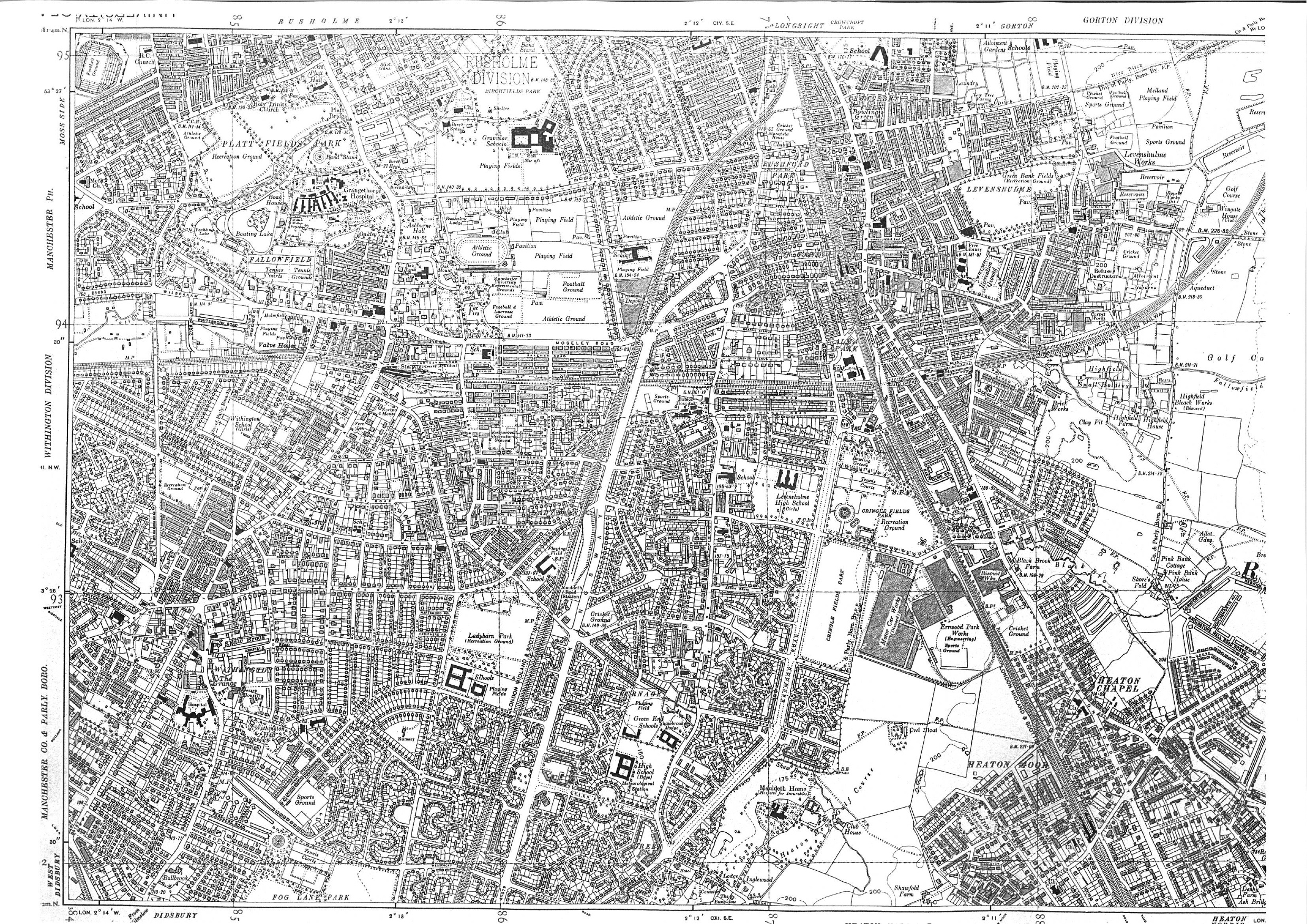
Both
maps reproduced by courtesy of the University Librarian
and Director, The John Rylands Library, The University of
Manchester.
For
collections of old maps of the Manchester area, including
specialist maps, see The
Manchester City Archives and John
Rylands Map Library.