Early history
Early (pre-conquest)
records of Withington do not appear to exist. Post-conquest
records (Wythinton 1212, 1243, 1278, 1332, Witheton 1219,
1222, Withinton 1255, 1325, Wythington 1246, 1282, Whytinton
1302/3, Witington 1292, Wydington and other variants),
together with the environment of the area and related names
elsewhere, support the origin of the place-name as Old
English "Within-ton" - a settlement ("ton/tun") associated
with willows (OE plural "withen/within").
St. James' church, Didsbury
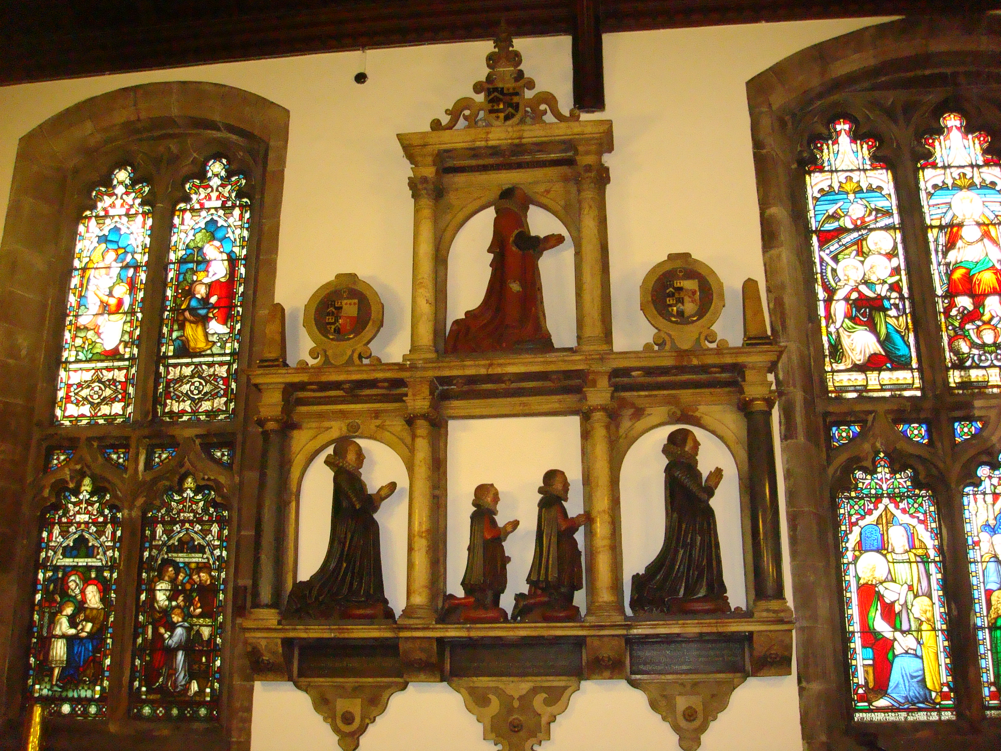
In the early 13th Century, Withington is recorded as an independent manor under the lordship of William de Withington. By the turn of the 14th Century, it had become a sub-manor of the manor of Manchester which was in the possession of the de Haversage family, then the de Longfords, followed by the Moseley family. The last lords of the manor of Withington were the Egertons of Tatton. See the Manorial history for more details.
Victorian development
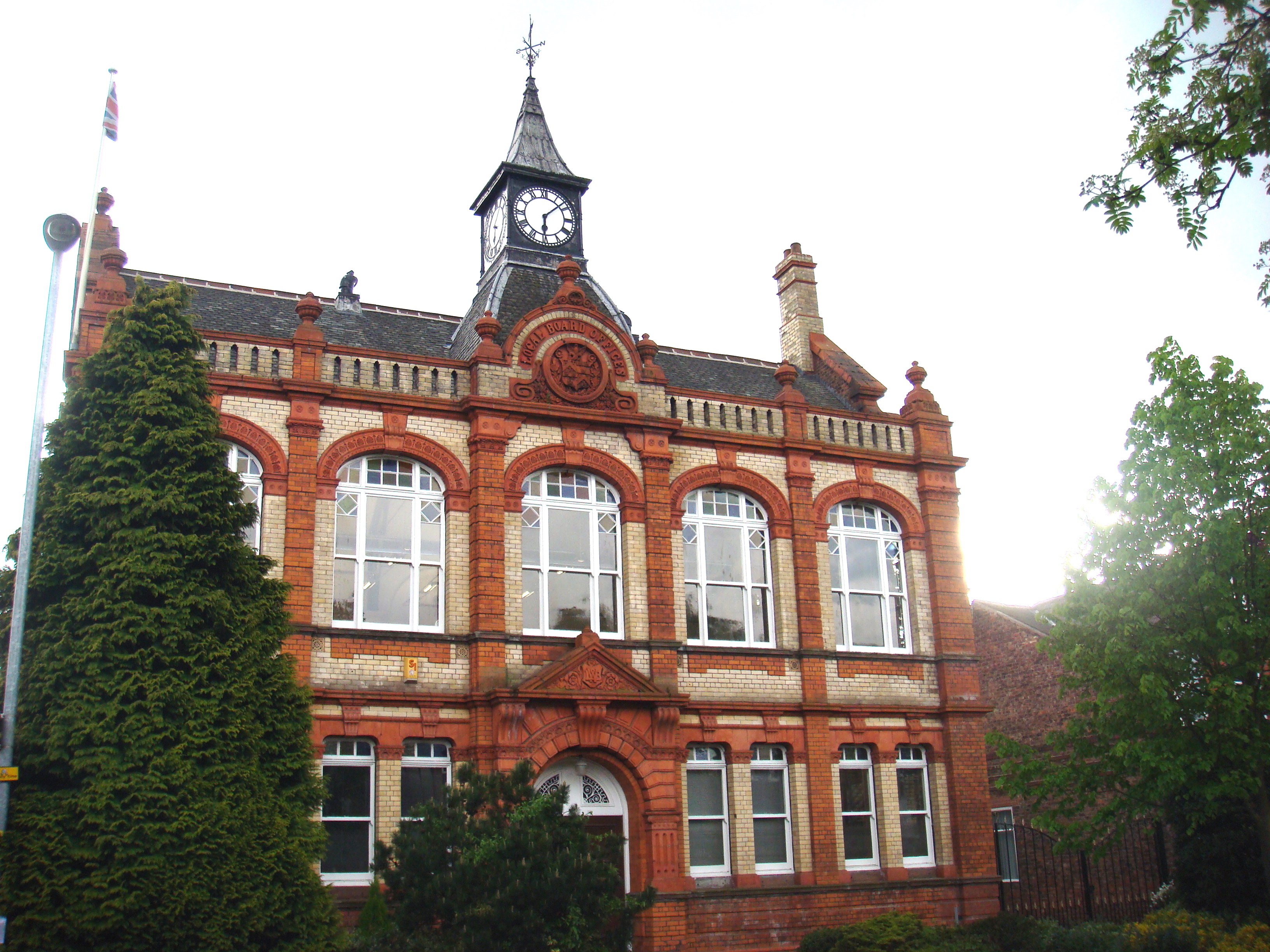
Town Hall
Withington remained virtually unchanged, as a small country village surrounded by fields, until the middle of the 19th Century when communications and transport improved with the establishment of the Manchester and Wilmslow Turnpike Trust, the construction of the Cheadle and Palatine Road bridges and the opening of the Midland Railway in 1880. From 1876, Withington was run by a Local Board with an extensive area of governance. Withington then became an Urban District Council (1894-1904). The former Withington Town Hall (1881) still remains on Lapwing Lane, near the junction with Palatine Road. In 1904, Withington was incorporated into the City of Manchester.
In 1870-72, John Marius Wilson's Imperial Gazetteer of England and Wales described Withington as follows:
WITHINGTON, a township and a chapelry in Manchester parish, Lancashire. The township lies 4 miles S of Manchester railway station; has a post-office‡ under Manchester; and includes Fallowfield, which also has a post-office under Manchester. Acres, 2,498. Real property, £16,747. Pop. in 1851, 1,492; in 1861, 2,712,-of whom 771 were in Chorlton workhouse. Houses, 347. The manor belongs to Lord Egerton. There are numerous villas and other good residences. Chorlton workhouse here was built in 1855, at a cost of about £53,000. The Lancashire Independent College also is here, but has been noticed in our article on Hulme.—The chapelry was constituted in 1854. Pop., 2,775. Houses, 359. The living is a rectory in the diocese of Manchester. Value, £362.* Patrons, Trustees. The church was built in 1841. There are a Wesleyan chapel and a national school.
This account gives a snapshot of Withington at the time. For example, note the number of people in the workhouse: 28% of the population in 1861. However, the "catchment area" of the workhouse extended well beyond Withington. The remaining people have a household occupancy of about 5 people per house, suggesting not only largish families but also live-in servants in many households. Indeed many of the larger Victorian houses in Withington still have the remains of servants' quarters.
Withington
Village - then and now
the site of the moat.
Withington Village centre and its surrounding area were designated a Conservation Area in 1983. The Conservation Area contains a number of listed buildings, including St. Paul's Church, the Red Lion, the White Lion (now a Sainsbury's store) and the former National Westminster Bank (the "Old Bank" building), amongst other buildings of historical and architectural interest throughout Withington, Old Moat and Ladybarn.
For a historical tour of Withington Village, see A walk through the history of Withington.
Old Moat
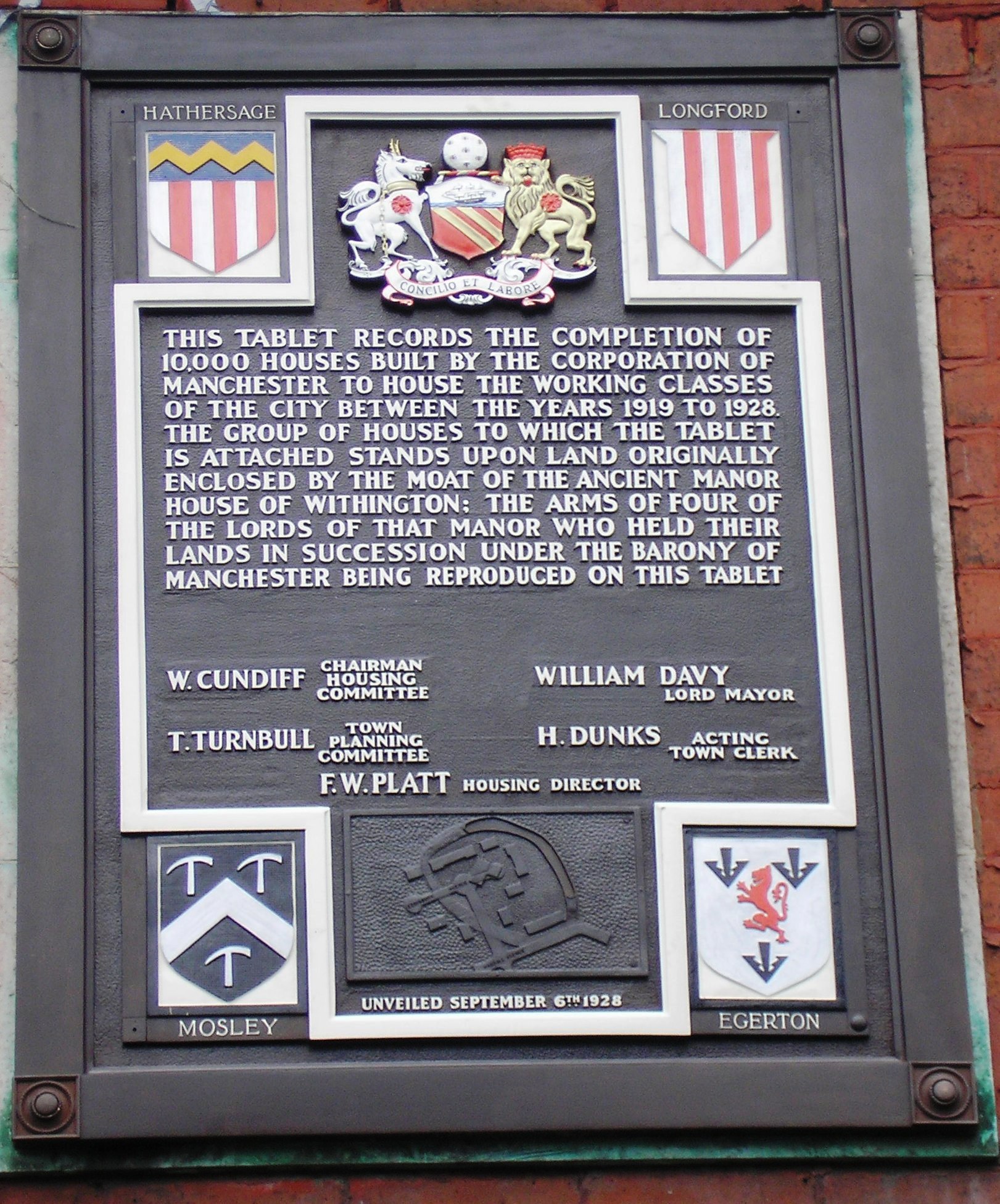
Old Moat takes its name from the site of a moated manor house immediately to the west of Withington village near the demolished Withington Old Hall. There is a plaque (dated Sept 1928) recording the site of the old moat. More details of the history of the area can be found on the Old Moat page.
Ladybarn
Ladybarn appears as a small group of buildings to the east of Withington, and surrounded by fields, on maps from the early nineteenth century. The tithe map of 1845-48 records Ladybarn as a district and field name. Lady Barn House was formerly used as a school (founded in 1873). More historical notes can be found on the Ladybarn page.
* See The place names of Lancashire, E. Ekwall, Manchester University Press, 1922. Available online at