Withington Green
Withington
Green is a roughly triangular piece of land at the junction of
Wilmslow Road (one of the principal roads south from
Manchester and once a turnpike road) and Cotton Lane (an old
thoroughfare from the east into Withington - see below). Johnson's Plan
of the Parish of Manchester (1820)
records the settlement at this junction as "Withington
Green", suggesting that the Green itself is considerably
older. Withington Green is marked on the Withington
Tithe Map of 1845-48, occupying the same land as
now and recorded as "public land".
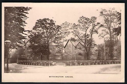
In
the Victorian
period and
later, ornamental trees and flower beds were introduced with
a variety of designs over the years. Old photographs and
postcards record many of these designs.
The
Green continued to be a public garden and green space for
the people of Withington until 2012, when The Christie and
the University of Manchester applied to build the a cancer
research centre behind the Green, threatening the existence
of the Green.
There
were considerable protests and legal moves to try to prevent
this destruction, including applying for Village Green
status, and responding to planning applications. A
compromise was agreed, with the building moved away from the
Green, and a new landscaped area on the site of Withington
Green. See the Protests
page for details of these events.
Here
are pictures of the Green before and after the
redevelopment. Click on the images to enlarge.
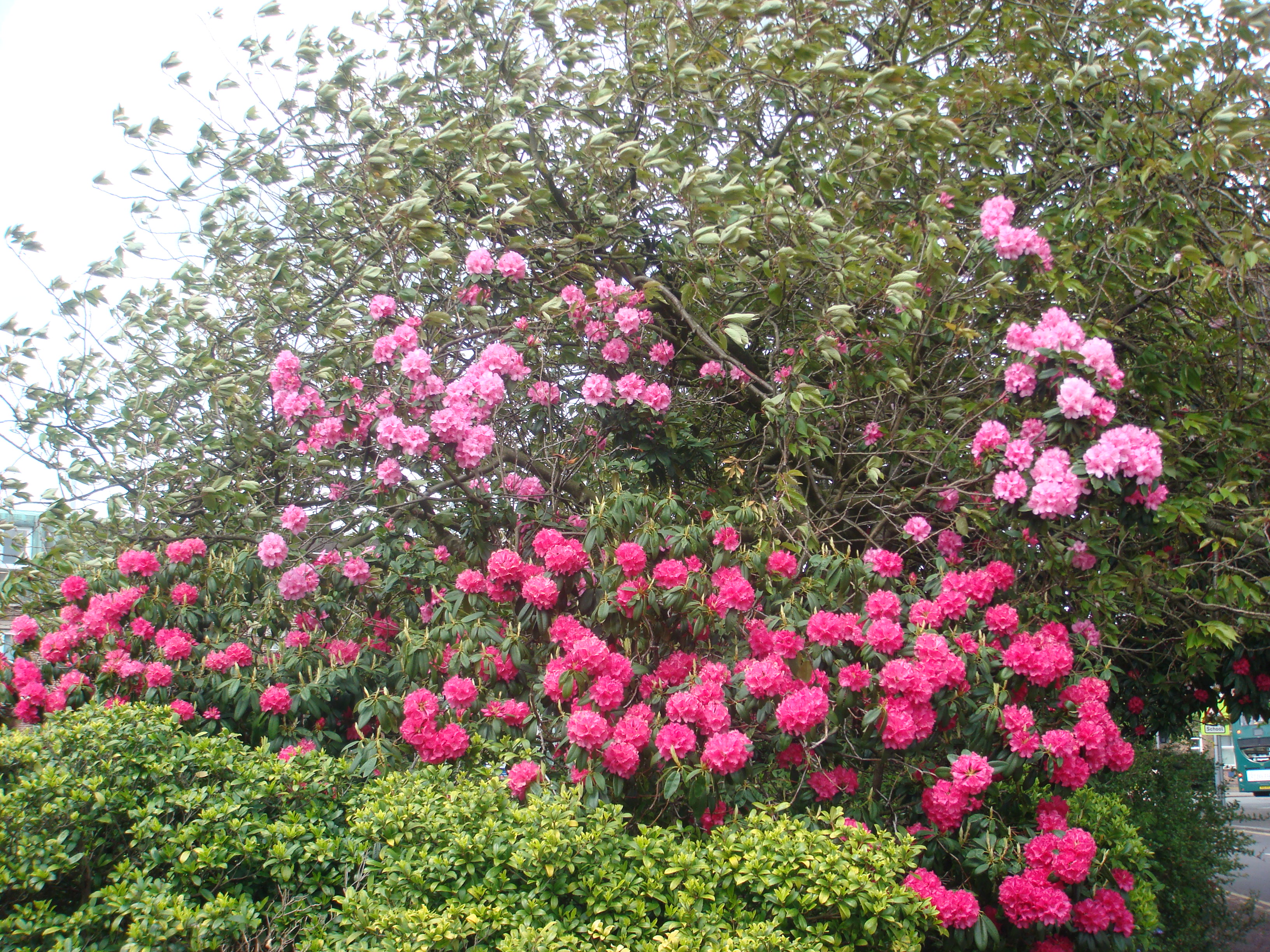 Springtime
rhododendrons on the Green
[2012]
|
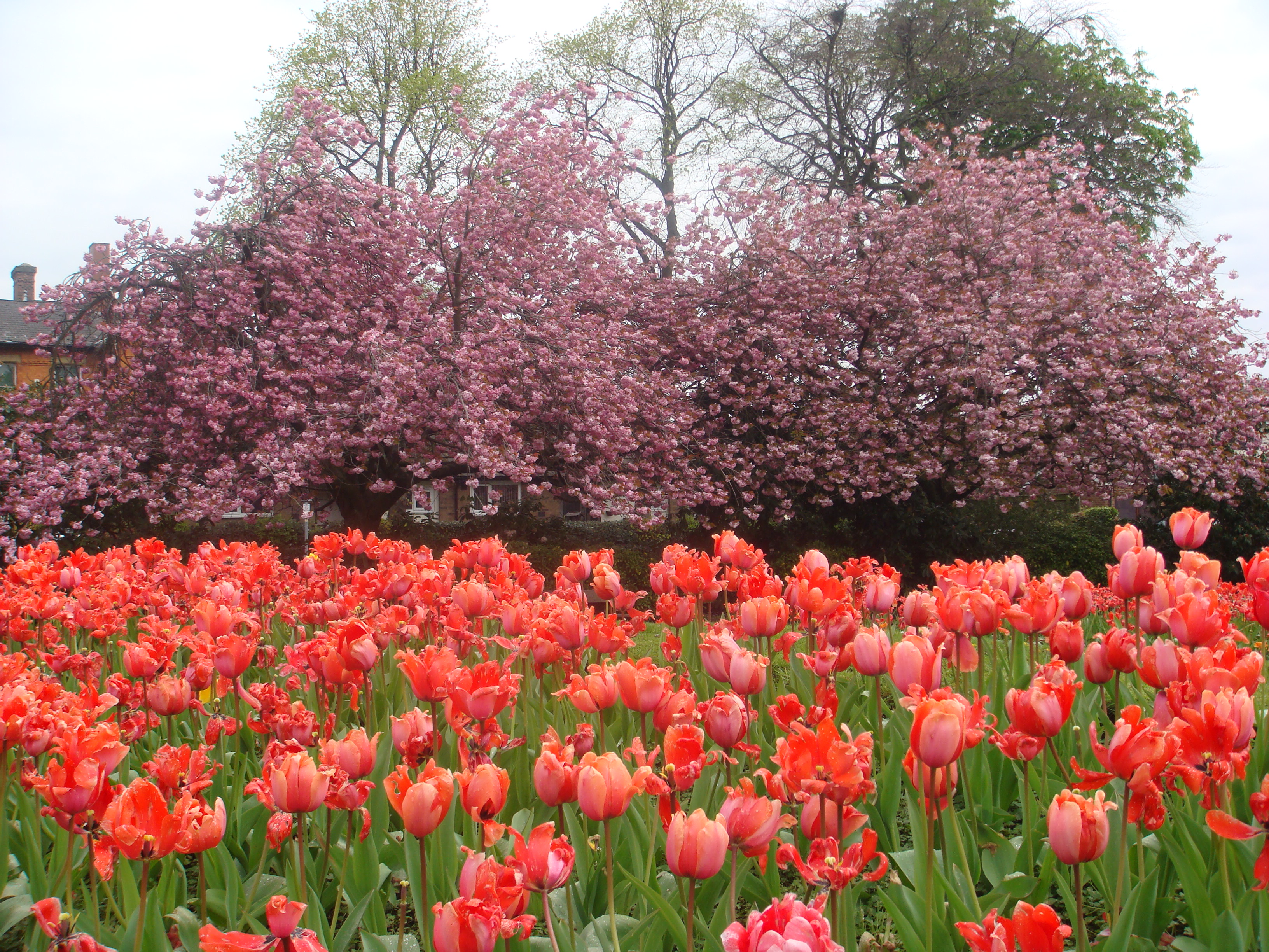 Tulips
and cherry blossom - the Green in Springtime. [April
2012]
|
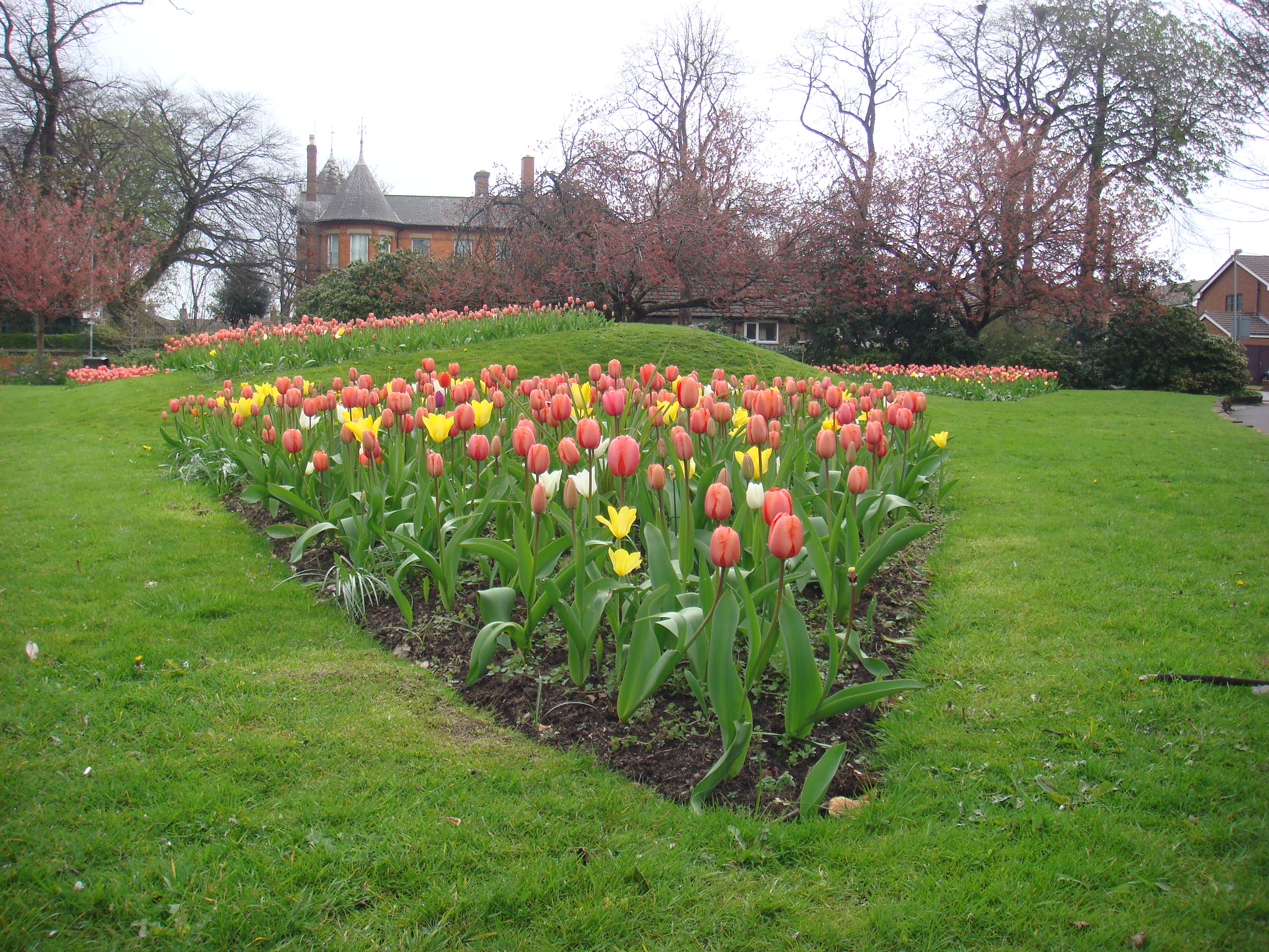 The
Green in the Spring, looking North, in
2012.
|
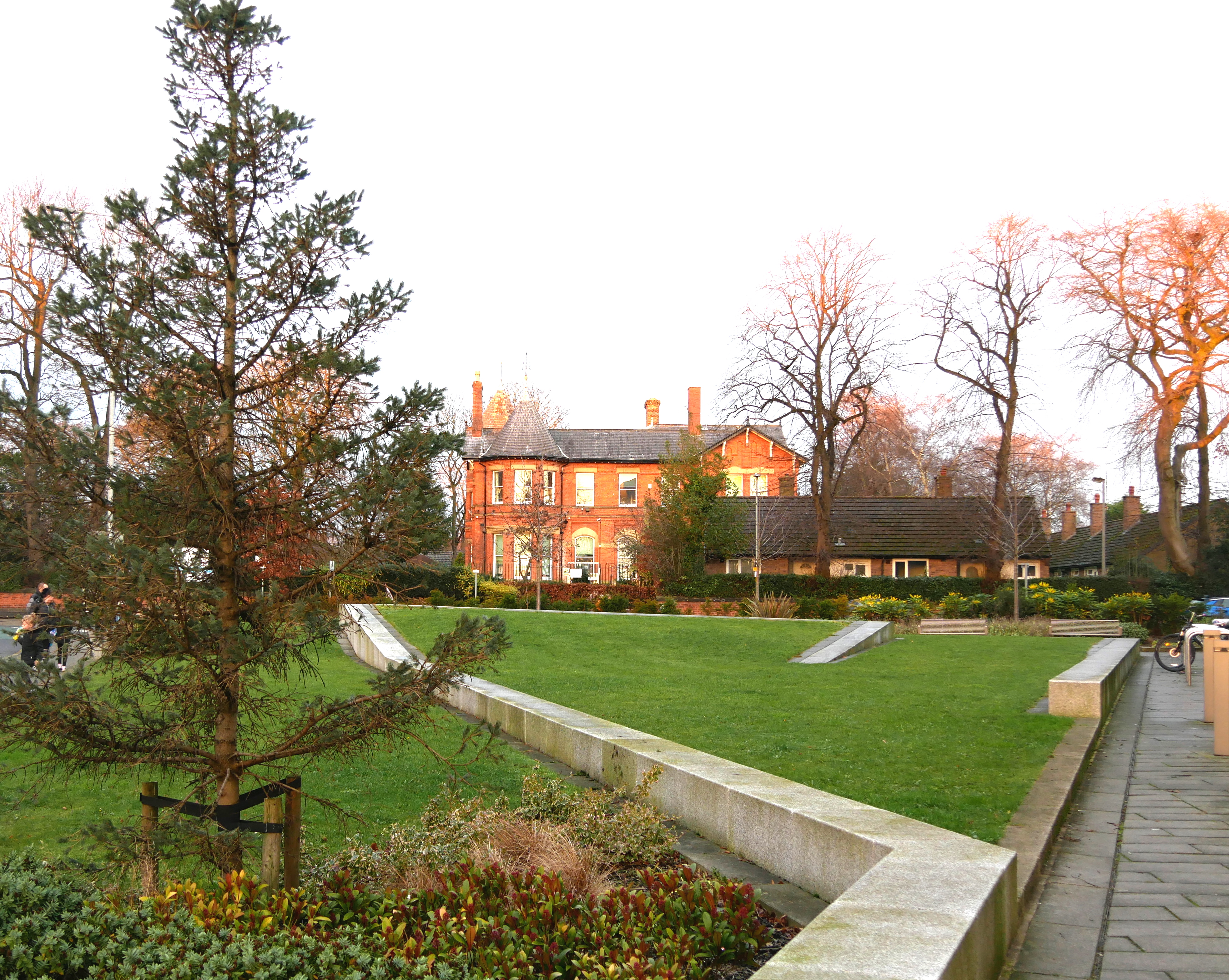 The
Green in 2019, as part of the design
for
the MCRC building. The view is
the
same as the picture on the left.
|
Cotton
Lane and Cotton Tree Field
Cotton Lane runs east from the Green. It is an ancient
thoroughfare, recorded on Johnson's Plan
of the Parish of Manchester (1820),
but is likely to be much older.
The
area to the east of the Green, variously called Cotton
Tree Field, Cotton Field or Cotton Doles, is a remnant
of one of the open fields of the ancient open field
system for Withington. The origin of these names is not
clear. Kenneth Whittaker (in A
History of Withington)
suggests the name probably comes from "co-town strips
making up the fields at the far end [of Cotton Lane]" -
part of the old open field system. (This may well be
correct, but "cotton tree" suggests poplar trees which
are occasionally known as "cotton trees" ("cottonwoods"
in the US) from the downy covering of the seeds from
female trees.) See
the Old
Maps page
for maps of this area through the ages.
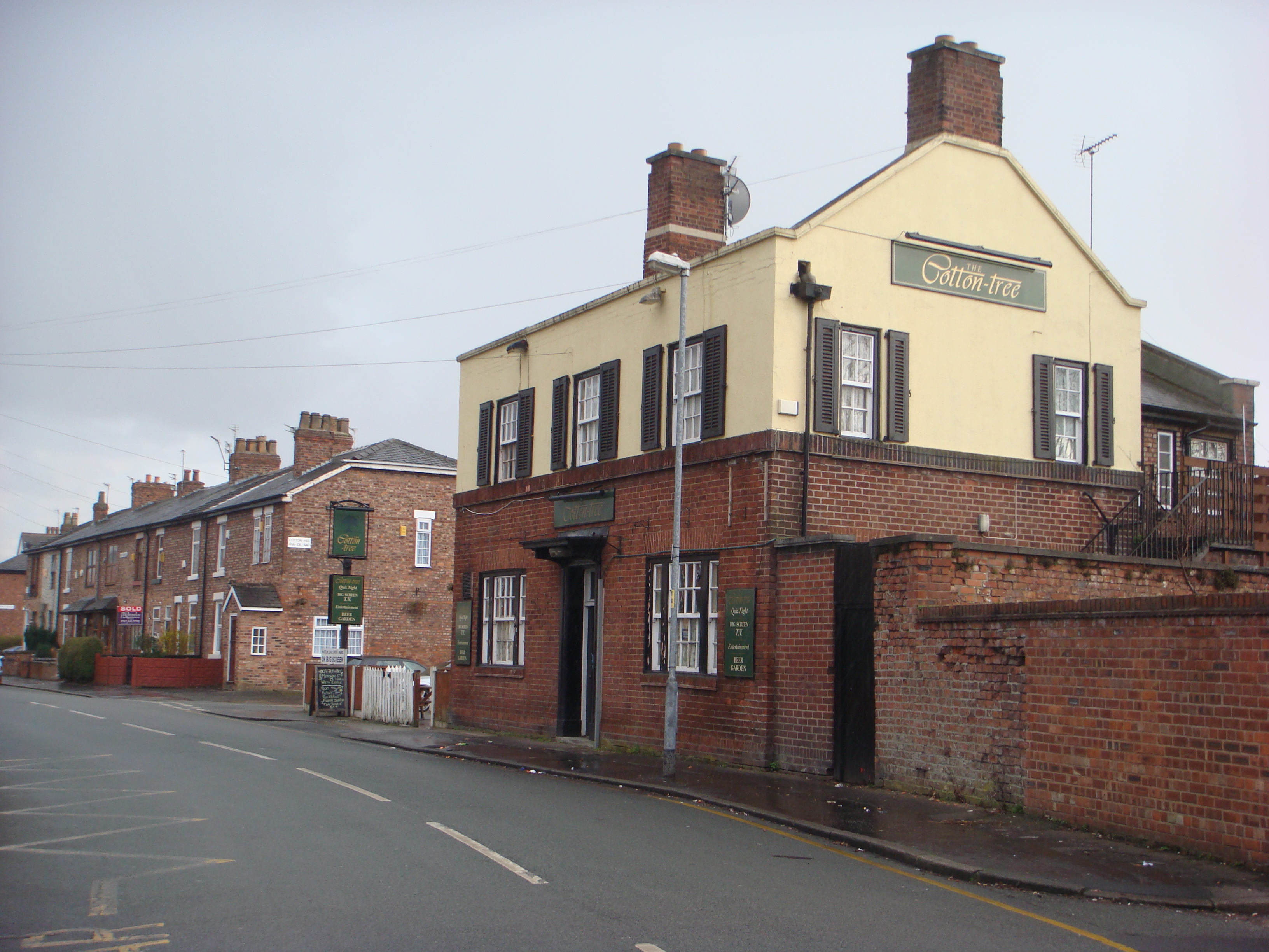
The
Cotton Tree public house (right), whose name records the
old Cotton Tree Field, was demolished in 2011.